| Part 4 Todgha Gorge |
|
|
I have felt uneasy about the difference between "gorge" (峡谷)
and "valley" (渓谷) in Japanese kanji letters.
For this Todgha landform, the guidebook of Diamond Publishing uses the
word 峡谷 and Trapics uses both of the words. According to the Japanese-English
dictionary of Obun Co., 峡谷= gorge, ravine, gully, canyon, notch(US) and
渓谷= valley, ravine, glen.
I call this spot Todgha Gorge following the explanation in Japanese Wikipedia.
|
|
 |
| Todgha River |
 |
|
|
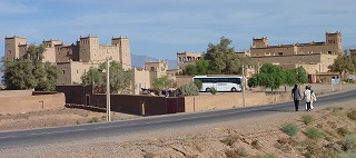
Monday, November 15. The 5th day.
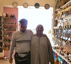
We left the hotel in Ouarzazate at 8:30. On the way, we took a rest at
a town Tineghir for 30 minutes. At a souvenir shop "Eau de Rose",
I bought an ammonite and another small stone, while bartering my ballpoint
pen for a necklace.
|
|
 |
|
 |
|
 |
| Both are shrewd. |
|
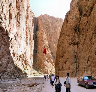
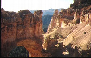
After the sign of "Gorges" on the roadside until Todgha Gorge,
the views were magnificent.
We are looking at a cliff-like view down to the river, which has a beauty
different from Doro Gorge in Nanki-Kumano near my hometown.
I admit every landscape in Morocco can be a movie scene, except for a melodrama
and a love story. And surely this path along the river, too, for any movie
like Western, action or suspense. Now I feel Morocco is a country of a
large variety of phases. |
|
|
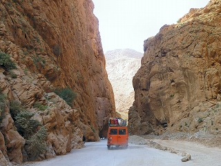
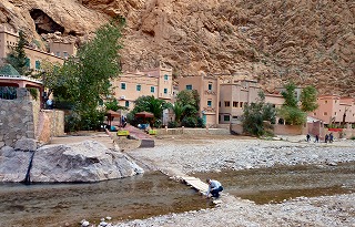
Todgha Gorge lies on the way along Kasbah path from Ouarzazate to the hotel
we stay in tonight around the entrance point toward Sahara Desert.
It is where sheer cliffs of more than 200 meters high rise on the both
sides of Todgha River. Their reddish-brown shade may be peculiar to the
area in Morocco. If a cowboy would appear on the riverside, ..., some movie
scene comes out to me. I am serious and don't think it is a queer imagination.
"Shane", the Western movie before, with the music "The call
of the far away hills."
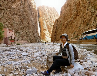
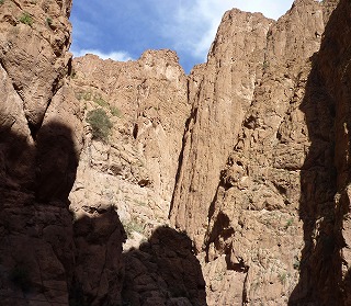
We took lunch of Tajine at a restaurant along the river, and walked around
for 1 hour and a half in total.
The view was so enchanting like a picture all right, but all the same,
the clear stream of the river could never be overlooked, which was fresh
and cold to my hands.
From here no traffic road, but a mountain path.
The guide says this path has a peculiar gorge landscape until the small
village Tamtattochte of Berber people, but it is 20 km away from here.
No way for us.
|
|
 |
|
 |
|
 |
| ………………………… |
|
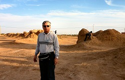
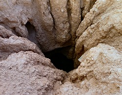
Still about 150 km until Erfoud. On the way we stopped by at Qanat, which
is a gently sloping underground channel to transport water from aquifer
or water well to surface for irrigation and drinking.
"This is an old system of water supply from a deep well with a series of vertical access shafts. The qanats still create a reliable supply of water for human settlements and irrigation in hot, arid and semi-arid climates. The qanat technology was developed in ancient Iran by the Persian people sometime in the early 1st millennium BC, and spread from there slowly westward and eastward." (Wikipedia)
It is such a sight of the endless wilderness with many buns or mounds scattered
straight.
|
|
 |
|
 |
|
 |
|
|
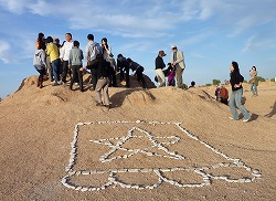
Where does the water come? It seems there was an underground water supply
and the water would have been drawn from the well dug under the mound.
What kind of village was it that the residents lived then? The well in
the desert?! Anyway, a strange view it is.
|
|
|
We arrived at the hotel early today, too. But the dinner was from 7:00
pm.
The Tajine dish also tastes nice to me. The soup and salad, too. It seems
there is nobody who dislikes the dish here. I drank local beer tonight.
We have to leave the hotel at 4:30 tomorrow morning in order to see the
sunrise in the desert. So, our couple went to bed right away.
|
| ………………………… |
| Two different gorges came out to my mind. |
|
|
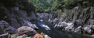
While half asleep, two landscapes emerged and overlapped with Todgha Gorge.
One is obviously Doro-haccho Valley in Nanki-Kumano near my hometown.
There is a magnificent gorge called Doro Gorge upstream of Kitayama River
running between Nara and Wakayama Prefecture. It consists of Oku-Doro,
Kami-Doro and Shimo-doro Valley from up.
Shimo-Doro is Doro-haccho Valley, and its beautiful sight with huge rocks,
strange rocks and cliffs makes tourists on a pleasure boat fascnated like
a dream.
The pleasure boat ran with a whirling propeller until about 30 years ago,
on which I got a couple of times and was troubled by the propeller's terribly
loud noise. Then it was changed to run with a jet engine, on which, 4 years
ago, I enjoyed both the scenery and the announcement with little noise.
|
|
 |
|
|
Especially in the season of autumn tints, a peculiar beauty of the valley
widens to your eyes. I believe this is not only the feeling of the hometown
fan. It goes without saying that its view is a different shape and atmosphere
from Todgha Gorge.
Going down from Doro-haccho Valley, the river becomes a little wide and
is called Kumano River near Kumano-Hongu Shrine, and finally flows into
the Pacific Ocean at the mouth in Shingu City, which is my hometown. |
|
|
- - - - -
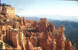
Another landscape, emerged while half asleep and overlapped with Todgha
Gorge was Bryce Canyon in the US. I once stopped there during my driving
travel across the country 40 years ago with 2 Japanese guys.
We stayed there for two days. The view and atmosphere gave me a deep impression,
not similar to the gorge between the cliffs, though.
|
|
 |
|
 |
|
|
Let's quit from its similarity or difference with Todgha Gorge. It is one
of the strange landscapes emerged while I was half asleep after all.
Concerning the drive across the US, it is carried in another corner "USA
69-70", but I will refer to it at Chapter 10, too.
|
|
| Todgha Gorge, Other Pictures |
|
| Qanat, Other Pictures |
|
| Reading: 10:52 |
|